Is the geothermal energy beneath our feet usable for heating our homes?
Exploring new energy with the SCAN Geothermal Energy project
The SCAN Geothermal project investigates the potential of geothermal energy as a sustainable alternative to fossil fuels. Geothermal energy is considered a possible future energy source for the Netherlands.
Background
The geothermal research is a collaboration between EBN, TNO, and the Ministry of Economic Affairs and Climate Policy. SCAN Geothermal is a nationwide project involving local research. It was crucial to extensively inform the involved municipalities and residents about the nature of the research, including specific locations and methods.
Initially, a dual-track communication strategy was adopted to explain the details of the research through clear and transparent communication and to build support for its implementation among residents and municipalities.
Project request
Due to our experience with previous government projects, FBI Digital was chosen to develop the digital information media for the SCAN Geothermal project. Our task was to design a website that functions as a communication platform for both residents and municipalities. The specific details of this task became clearer during the development process.
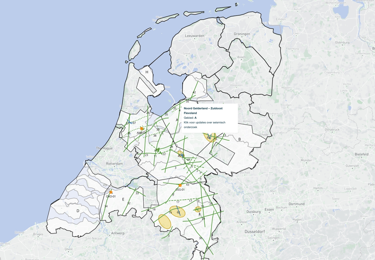
From the start, it was known that the website would use GIS maps to outline the research lines. These lines would be crucial for announcing the planned investigations. Additionally, the website would provide an easy way for the public to report complaints and damages, in line with our commitment to transparent communication.
Our solution
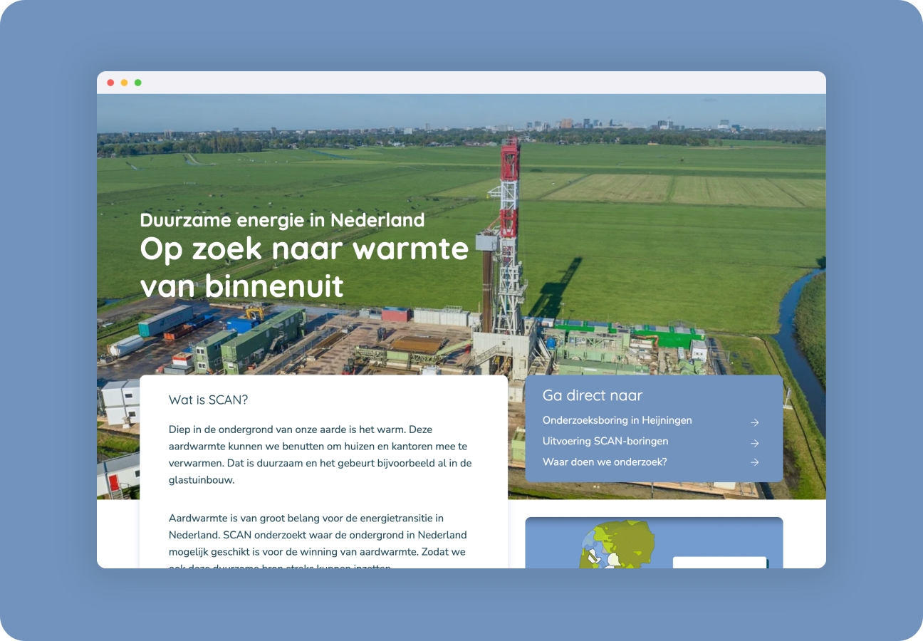
In response to the project objective, we developed a website that serves as the primary communication tool in the field. Initially, the plan was to offer the information on two separate platforms for the public and municipalities. This plan was adjusted when it became clear that a single website could efficiently serve both target groups.
A key success factor in this project was our handling of complex GIS data. With our knowledge and technical expertise, we were able to successfully convert this data into a user-friendly web format. This process, supported by the Mapbox Software Development Kit, contributed to a clear and accessible website that supports communication about the SCAN geothermal project.
The result
The use of Mapbox for data conversion provided an effective solution. The website now features a comprehensive line map with a legend, making it easy for the general public to access understandable information about geothermal research in the Netherlands. In addition to extensive information about the research, the website displays historical and future research lines through timelines. User-friendly forms for reporting complaints and damages are also available.
Technologies & services
In the SCAN Geothermal project, we applied an integrated approach, focusing on UX design, visual design, front- and back-end development, and GIS data conversion with Mapbox. We designed an intuitive user interface to make complex geographic data accessible, developed robust systems for fast data processing, and used Mapbox for dynamic, accurate visualizations of research areas. This multidisciplinary effort resulted in an informative and efficient website that is essential for increasing public engagement and promoting transparent communication within the project.
View projectHighlights
-
The number of organic visitors (SEO) doubled in the first year
-
Municipalities and citizens have been well informed about the developments surrounding SCAN
-
Effective visualization of GIS data
-
Use of Mapbox for advanced data conversion
let’s talk about tech
Curious about the possibilities for your organization?
Discover the power of innovation: Schedule an introduction to FBI Digital or learn more about our services. Let's talk tech for your business!